UN
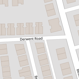
16 Derwent Road
£ 207,500
Description
We don't have a Description for this property.
- Bedrooms
- 3
- Bathrooms
- 0

Leaflet © OpenStreetMap contributors
The heatmap indicates the level of crime in the area. The color of the heatmap indicates the crime severity and recency.
Metrics Year-on-Year
- Average area value
- 245,042.00 £Decreased by 7.12 %
- Average area rental value
- 861.00 £/moIncreased by 13.29 %
- Est rental Yield
- 4.22 %Increased by 21.97 %
- Crime Rate
- 3.00 %Unchanged by 0.00 %
from 263,830.00 £
from 760.00 £/mo
from 3.46 %
from 3.00 %
Nearby Schools
| Name | Type | Ofsted | Distance |
|---|---|---|---|
| Prenton Preparatory School | Other Independent School | 0.53 KM | |
| Woodchurch Road Primary School | Community School | Requires improvement | 0.54 KM |
| St Joseph'S Catholic Primary School, Birkenhead | Academy Sponsor Led | 0.66 KM | |
| Birkenhead Christ Church Cofe Primary School | Voluntary Aided School | Good | 0.78 KM |
| Birkenhead Park School | Academy Sponsor Led | Requires improvement | 0.98 KM |
Images
Nearby Streets
| Name | Average Price | Average Sqft | Distance |
|---|---|---|---|
| Dudley Close | £ 0 | 0 | 0.00 KM |
| Columbia Lane | £ 850,000 | 0 | 0.00 KM |
| Devonshire Road | £ 150,000 | 0 | 0.00 KM |
| Grange Mount | £ 115,000 | 0 | 0.00 KM |
| Alexandra Road | £ 0 | 0 | 0.00 KM |
Nearby Transport
| Name | NLC | TLC | Distance |
|---|---|---|---|
| Birkenhead Park | 2220 | BKP | 1.70 KM |
| Birkenhead Central | 2217 | BKC | 2.26 KM |
| Conway Park | 3624 | CNP | 2.31 KM |
| Green Lane | 2218 | GNL | 2.64 KM |
| Birkenhead North | 2145 | BKN | 3.13 KM |
Nearby Listings
| Address | Price | Type | Score | Distance |
|---|---|---|---|---|
| Derwent Road, Oxton, Wirral, CH43 | £ 250,000 | BUY | 7 / 10 | 0.01 KM |
| Derwent Road, Oxton, CH43 | £ 260,000 | BUY | Unknown | 0.03 KM |
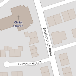
| Gilmour Mount, Prenton, Wirral | £ 325,000 | BUY | 7 / 10 | 0.05 KM |
| Normanston Road, Oxton, Wirral | £ 400,000 | BUY | 6 / 10 | 0.05 KM |
| Bentley Road, Prenton, Wirral | £ 250,000 | BUY | Unknown | 0.09 KM |
Nearby Properties
| Address | Price | Distance |
|---|---|---|
| 24 Derwent Road | £ 182,000 | 0.00 KM |
| 16 Derwent Road | £ 207,500 | 0.00 KM |
| 18 Derwent Road | £ 167,500 | 0.00 KM |
| 2 Derwent Road | £ 164,950 | 0.01 KM |
| 6 Derwent Road | £ 232,000 | 0.01 KM |